Current Developments in the 2024 Atlantic Hurricane Season: Monitoring Systems in the Gulf of Mexico

The 2024 Atlantic hurricane season is ongoing, with two systems being monitored by the National Hurricane Center. One system has a 50% chance of developing, while another shows little chance of formation. The season has recorded 13 named storms, including nine hurricanes, highlighting an active period in tropical weather.
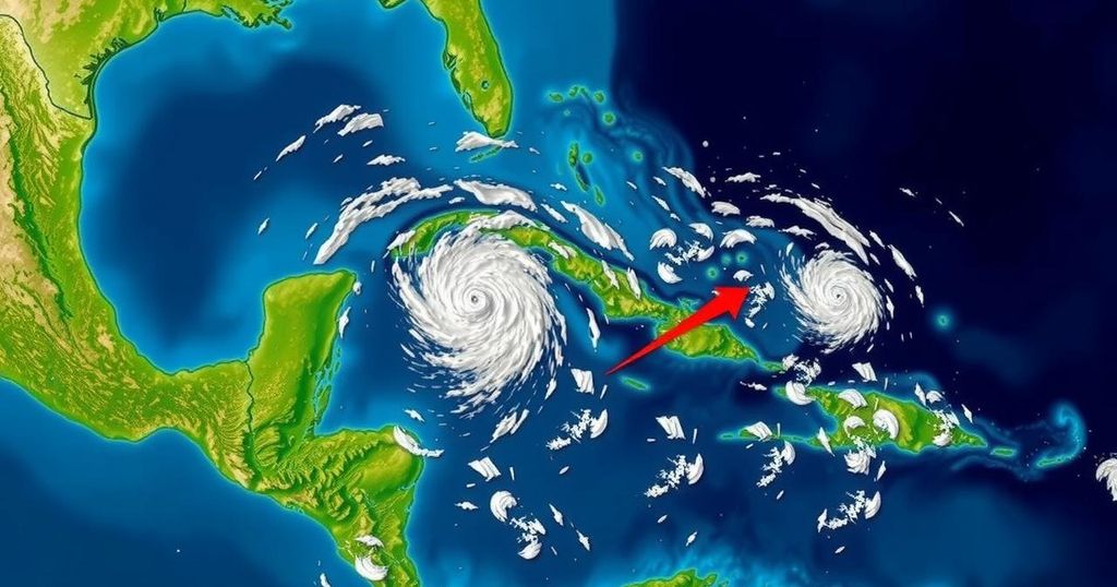
The 2024 Atlantic hurricane season continues to exhibit notable activity, as the National Hurricane Center (NHC) is currently monitoring two distinct systems in the tropics. One of these systems has demonstrated some degree of development, heightening the possibility of further strengthening, yet it may not align with the expectations of the broader public. This situation serves as a crucial reminder that even storms which appear less likely to intensify can do so rapidly and warrant vigilant observation. Recent developments come in the wake of a previous concern regarding another system that many anticipated would morph into Tropical Storm Nadine shortly after Hurricane Milton impacted Florida. However, that system ultimately dissipated in the open Atlantic, posing no danger to land. As it stands, it remains feasible that one of the current systems may evolve into Tropical Storm Nadine. Track Path: An Overview of Two Systems in the Gulf of Mexico Disturbance 1: Currently, a trough of low pressure is generating disorganized showers and thunderstorms situated a few hundred miles north of Puerto Rico and the Virgin Islands. This disturbance is moving predominantly westward to west-northwestward at an approximate speed of 20 mph. It is projected to traverse north of Puerto Rico and the Virgin Islands before closely approaching Hispaniola and the southeastern Bahamas over the weekend. Environmental conditions appear unfavorable for development, and strong upper-level winds anticipated early next week could impede further intensification. – Formation Chance through 48 hours: Low, estimated at 10%. – Formation Chance through 7 days: Low, estimated at 10%. Disturbance 2: A broad area of low pressure located north of eastern Honduras is exhibiting improved organization, characterized by widespread showers and thunderstorms. The environmental conditions are currently conducive for additional development within the next day or so. There exists a potential for this system to momentarily develop into either a tropical depression or storm before making landfall over Belize and the Yucatan Peninsula of Mexico by Saturday. Regardless of its developmental status, this system is anticipated to deliver heavy rainfall across segments of Central America and southern Mexico during the weekend. – Formation Chance through 48 hours: Medium, estimated at 50%. – Formation Chance through 7 days: Medium, estimated at 50%. Current Season Statistics As of now, the 2024 Atlantic hurricane season has recorded a total of 13 named storms, with nine of these evolving into hurricanes. Notably, four of these hurricanes have been classified as major hurricanes, reaching Category 3 or higher on the Saffir-Simpson scale. Early forecasts had posited the possibility of a record-breaking hurricane season, with predictions ranging between 17 to 24 named storms, including eight to 13 hurricanes. In contrast, a typical hurricane season averages approximately 14 named storms, inclusive of seven hurricanes. Hurricane Season Duration The Atlantic hurricane season officially runs from June 1 through November 30 of each year.
The Atlantic hurricane season is characterized as a significant weather phenomenon occurring annually from June to November. During this period, numerous weather systems can evolve into tropical storms or hurricanes, with varying levels of intensity. The National Hurricane Center plays a crucial role in monitoring these systems, providing valuable information related to their formation, expected paths, and potential impacts on land. The current season’s statistical data is pivotal for understanding trends and preparing for future weather developments.
In summary, the National Hurricane Center is actively monitoring two systems in the Gulf of Mexico, one of which harbors a moderate chance of development. While a prior system dissipated without threat, the possibility remains that the current disturbances could manifest into a tropical storm, potentially named Nadine. With the overall hurricane season showing heightened activity, continued vigilance is essential as developments unfold.
Original Source: www.statesman.com


