Tropical Development Monitoring: Potential Systems in the Caribbean and Atlantic

Meteorologists are tracking three areas for potential tropical development: one in the southwestern Caribbean and two near the northeastern Caribbean. A tropical depression could form this weekend, with varying likelihoods of formation impacting weather across the region. Historical data shows limited hurricane activity in Florida during November, underscoring the significance of staying informed as the hurricane season concludes.
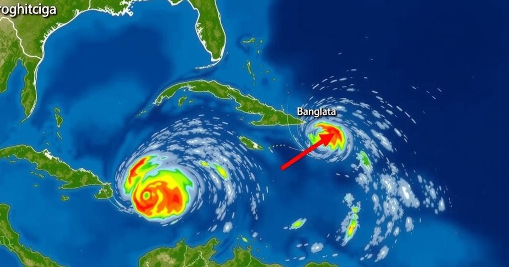
On Thursday, October 31, 2024, meteorologists are monitoring three distinct areas that may develop into tropical systems, with significant attention on two regions within the Caribbean and one in the North Atlantic. 1. Southwestern Caribbean Sea: A broad low-pressure system is anticipated to emerge over the southwestern Caribbean Sea within the next few days. Some development is feasible, potentially resulting in the formation of a tropical depression as early as the upcoming weekend. This system is expected to drift generally northward or northwestward across the central or western Caribbean Sea. Regardless of any potential development, heavy rainfall is expected over the coming days, particularly from Nicaragua southeastward and to northern Colombia. – Formation chance within 48 hours: low (10 percent). – Formation chance within 7 days: medium (60 percent). 2. Northeastern Caribbean Sea and Greater Antilles: A trough of low-pressure near Puerto Rico is generating cloudiness and precipitation across regions including the Dominican Republic, Puerto Rico, and the Northern Leeward Islands, along with adjacent waters. Development of this system appears slow over the next two to three days as it migrates west-northwest near the Greater Antilles. Ultimately, this system is expected to merge with the aforementioned low-pressure system over the Caribbean Sea, bringing the potential for heavy rains from the northern Leeward Islands westward across Puerto Rico and Hispaniola towards eastern Cuba and the southeastern Bahamas. – Formation chance within 48 hours: low (10 percent). – Formation chance within 7 days: low (10 percent). The GFS and ECMWF weather models indicate the possibility of these low-pressure systems merging over the weekend, with a tropical depression likely forming shortly thereafter. The trajectory and strength of this system will depend on the position of a high-pressure ridge to the east of Florida and the speed and intensity of an advancing cold front. It is crucial to note that definitive tracks should not be utilized at this stage; as developments occur, more precise predictive models will become available. If a system were to form, it would be designated with the name “Patty.” Historically, only three hurricanes have made landfall in Florida during the month of November since 1851: 1. The 1935 Miami Hurricane, which struck Miami with winds reaching 100 mph. 2. Hurricane Kate in 1985, which made landfall in Mexico Beach with similar wind speeds, marking the latest hurricane to hit the United States in November. 3. Hurricane Nicole in 2022, landing in Vero Beach with 75 mph gusts. 3. North Atlantic: A non-tropical low-pressure area approximately 550 miles west of the Azores has experienced the development of showers and thunderstorms. However, further development into a subtropical or tropical cyclone is anticipated to be slow as the system progresses eastward in the coming days. – Formation chance within 48 hours: low (20 percent). – Formation chance within 7 days: low (20 percent). As the hurricane season nears its conclusion on November 30th, residents are encouraged to remain vigilant and informed about tropical developments, especially as Florida transitions into its typical dry season.
In the context of tropical meteorological observations, this report highlights areas of interest where tropical systems may develop. The monitoring of weather patterns, particularly in the Caribbean and North Atlantic regions, is vital as these systems can impact weather conditions across the southeastern United States, especially Florida, a state that is often affected by hurricanes and tropical storms. Understanding the conditions surrounding potential tropical system formations, including atmospheric pressures and precipitation trends, is crucial for preparedness and public safety, especially at this time of year when system developments are most likely as the hurricane season draws to a close.
In summary, the forecast for tropical developments highlights two potential systems in the Caribbean with varying degrees of uncertainty regarding their formation and trajectory. Notably, only three hurricanes have historically impacted Florida in November, emphasizing the importance of being alert as the season approaches its end. Ongoing monitoring and updates will be essential as weather models develop clearer predictions over the coming days.
Original Source: www.fox4now.com


