Monitoring Tropical Storm Development in the Caribbean and Atlantic: An Update from the NHC
The National Hurricane Center is monitoring three possible tropical storm systems in the Caribbean and Atlantic, particularly one in the southwestern Caribbean with a growing likelihood of forming into a named storm. Heavy rains are anticipated across several islands, while Florida is likely to remain unaffected by any major storms due to prevailing high-pressure systems.
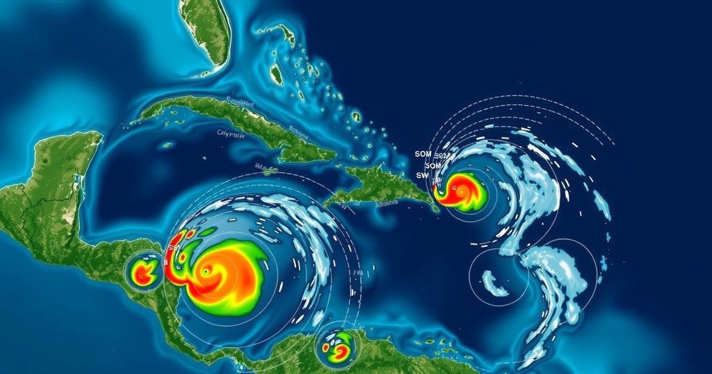
The National Hurricane Center (NHC) is monitoring three areas of potential storm development in the Caribbean and Atlantic regions. One notable area is situated in the southwestern Caribbean, which has a 30 percent probability of evolving into a tropical system over the next two days, escalating to a 70 percent chance within a week. Forecasts suggest it may become a tropical depression or named storm, potentially dubbed “Patty,” by late this weekend or early next week. Meteorologists anticipate that this system may drift north or northwest and could be influenced by high pressure forming in the Atlantic, directing it toward the Gulf of Mexico. In addition to the Caribbean system, a low-pressure trough near Puerto Rico is causing heavy rain across the Greater Antilles, which is expected to merge with the Caribbean area of interest. Although slow development of this new system is feasible, forecasters indicate it will likely bring significant rainfall to the northern Leeward Islands, Puerto Rico, and eastern Cuba in the coming days. Experts caution that any tropic system crossing the Caribbean should be monitored closely as it travels across warm waters, though if it persists into the Gulf, cooler waters may inhibit its strength. High wind shear and dry air in the Gulf could further pose challenges to the storm’s intensity. It is considered less likely that Florida will be impacted, as a high-pressure system is expected to redirect any approaching storms toward the northern Gulf coast, significantly diminishing the risk of major hurricane impacts in the region. In the North Atlantic, a non-tropical low-pressure area is identified about 400 miles west of the Azores, with a slight 10 percent chance of subtropical development as it shifts eastward over the upcoming week.
This article addresses the recent monitoring activities by the National Hurricane Center concerning potential tropical storm formation in the Caribbean and Atlantic. As tropical storm activity is of critical importance during hurricane season, the developments being observed are significant for forecasting potential impacts on coastal areas, particularly for regions like Florida, which could experience shifts in storm tracks. The presence of low-pressure areas, combined with atmospheric conditions, influences the likelihood of storm development and the projected paths they may take.
In summary, the National Hurricane Center is currently tracking multiple areas of interest for tropical storm development in the Caribbean and Atlantic, particularly focusing on a system with growing probabilities of forming into a tropical depression or storm in the coming days. The implications for storm track, potential rainfall, and impacts on Florida and surrounding regions are crucial areas of consideration for meteorologists and the public alike. Future developments will be monitored, particularly as this season approaches its conclusion.
Original Source: patch.com