Emergency Response to Fuego Volcano Eruption in Guatemala
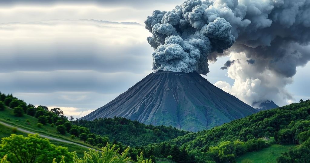
On March 9, 2025, Fuego volcano erupted, leading to the evacuation of approximately 900 individuals from affected areas. The eruption produced significant ash and gas emissions, prompting an Orange Alert status. Emergency services are actively responding to the potential hazards posed by ongoing volcanic activity and lahar risks.
On March 9, 2025, Guatemala’s Fuego volcano erupted, necessitating the evacuation of nearly 900 people. As reported by the National Coordinator for Disaster Reduction (CONRED), 125 families were relocated from El Porvenir in Alotenango due to this eruption, which prompted an Orange Alert and emergency protocols. Evacuees were sheltered temporarily at the Alotenango municipal hall.
According to the National Institute of Seismology, Volcanology, Meteorology, and Hydrology (INSIVUMEH), the eruption commenced around 03:00 UTC. This marked the first significant activity after a 49-day interim of quiescence, with ongoing effusive eruption reported into March 10. Incandescent fountains ascended to 500 meters above the crater, while dense ash and gas columns reached altitudes of 6 kilometers.
During the eruption’s peak, pyroclastic flows surged through the Las Lajas, El Jute, Seca, and Ceniza ravines, delivering swift mixtures of heat, ash, and debris. Loud explosion noises akin to a train engine resonated across several kilometers, indicating heightened volcanic activity and prompting the declaration of an Orange Alert, which denotes high danger.
Guatemala follows a structured alert system, from Green (normal monitoring) to Yellow (preparedness planning) and ultimately to Red (mandatory evacuations). In response to the Orange Alert, CONRED implemented humanitarian efforts for evacuees and convened local leaders for emergency planning. Key infrastructure such as National Route 14 was closed, impacting connectivity with Antigua, and educational activities were halted in several municipalities.
Ashfall was reported in San Miguel Pochuta, raising concerns regarding respiratory issues and agricultural viability. CONRED urged citizens to adhere to official guidance, avoid any ravines prone to lahar risks, and assemble 72-hour emergency kits. The Guatemalan Volcanic Surveillance Observatory (OGVV) recommended air traffic precautions due to potential ash dispersion, coinciding with the temporary restriction of tourist access to Fuego and Acatenango volcanoes.
The risk of lahars continues to persist due to heavy deposits of ash combined with potential rainfall. Emergency services remain vigilant as volcanic activity persists, with pyroclastic flows and ash columns extending up to 4.8 kilometers above sea level. Fuego, at 3,763 meters, is recognized as one of Central America’s most active volcanoes, with its deadliest eruption recorded on June 3, 2018, which resulted in the tragic loss of 215 lives.
In summary, the eruption of Fuego volcano has necessitated significant emergency response measures, including the evacuation of nearly 900 residents and the mobilization of humanitarian aid. The increased volcanic activity poses threats such as pyroclastic flows and ash dispersion, leading to health and agricultural concerns. Adherence to evacuation protocols and public safety measures remains paramount as the situation continues to evolve at this active volcano.
Original Source: watchers.news